
Monsal Dale - Peak District Walk
Sunday 26th May 2013
It isn't often John and I walk in the Peak District on a bank holiday weekend, but as the forecast was so good and it had been over a year since John had been out walking in the Peak District we decided to go for it. As nice as it was to be out with John it certainly reminded me how lucky I am to be able to walk mid-week, when most people are at work.
Start: White Lodge car park (SK 1704 7063)
Route: White Lodge car park - Monsal Dale - Monsal Trail - Water-cum-Jolly Dale - Miller's Dale - Litton Mill - High Dale - Brushfield Hough - White Lodge car park
Distance: 6.25 miles Ascent: 375 metres Time Taken: 3 hours 50 mins
Terrain: Clear tracks.
Weather: Hot and sunny.
Pub Visited: The Druid Inn, Birchover Ale Drunk: Abbeydale Brewery, Brimstone

The first section of the walk is through the trees that line the side of Monsal Dale.

We timed our arrival at the weir well as we had it to ourselves and it is a popular spot for photographers.

There are plenty of people up on the Monsal Trail.

This family of ducks weren't in the least bit interested in all the people who were milling about.

Don't be fooled this is about as quiet as it got on the short section of the Monsal Trail we walked along. Let's just say there can't have been many bikes left to hire at Hassop Station.

Upperdale Farm from the Monsal Trail.

We were heading for Cressbrook Mill at the head of the dale.

The weir at Water-cum-Jolly.

Looking across to the Rubicon Wall at Water-cum-Jolly.

Heading into Miller's Dale.

The further along Miller's Dale we got the quieter it got.

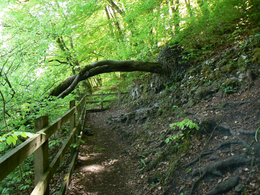
From this angle the trees appear to be forming an arch over the river.
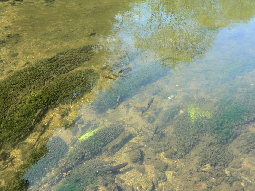
Crossing the river at Litton Mill we paused to watch the fish below us.
Leaving Litton the path appears to be blocked.

Crossing back over the Monsal Trail and only the really keen cyclists seem to have ventured this far along it.

Climbing up above Litton and the view soon opens up. This is the view north-west over Miller's Dale.

We had lunch admiring the view across the top of Miller's Dale. Here looking towards Wardlow Hay Cop and Longstone Moor.

Heading down into High Dale.

We had the dale to ourselves as most people just follow the track used by the 4-by-4's to Brushfield. This route is prettier and quieter.

It's always frustrating at this time of year to be able to see the hill on the other side of the wall covered with Cowslips but not be able to get close to them.

Following the track from Brushfield the view extends across the top of Taddington Dale. From here it looks so inviting, if only the busy A6 didn't run through it.

As we approach Brushfield Hough Fin Cop on the other side of Monsal Dale comes into view.
All pictures copyright © Peak Walker 2006-2023